Introduction
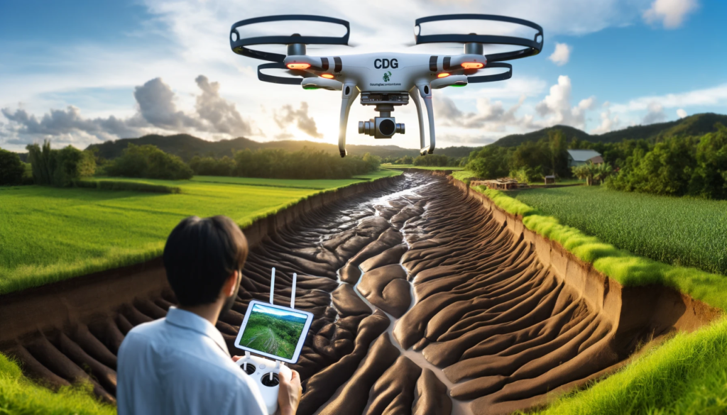
In the quest for environmental stewardship, understanding soil erosion is paramount. It’s a silent threat, often unnoticed until it’s too late. But fear not, for technology is our ally. At CDG, we pioneer the use of drones for soil erosion inspections, offering a bird’s-eye view to safeguard our precious earth. Join us as we delve into the depths of this crucial service, exploring its benefits and applications.
Understanding Soil Erosion
Before we soar into the skies, let’s grasp the gravity of soil erosion. It’s a natural process, exacerbated by human activities like deforestation and improper land use. When soil erodes, it loses its fertility, disrupts ecosystems, and even causes landslides. In essence, it’s a silent killer of our agricultural lands and natural habitats.
The Role of Drones
Enter drones, the unsung heroes of modern technology. These aerial marvels offer a unique perspective, revolutionizing the way we inspect soil erosion. Equipped with high-resolution cameras and advanced sensors, drones can capture detailed images of vast terrains with unparalleled accuracy. This capability enables us to detect erosion hotspots, analyze soil health, and devise targeted conservation strategies.
Benefits of Drone Soil Erosion Inspections
Precision: Drones provide precise data, allowing us to pinpoint erosion-prone areas with surgical precision. This targeted approach saves time and resources while maximizing effectiveness.
Efficiency: Traditional soil erosion inspections are labor-intensive and time-consuming. With drones, we can cover large areas in a fraction of the time, accelerating the inspection process without compromising accuracy.
Cost-Effectiveness: By streamlining the inspection process, drones help us optimize resources and minimize costs. This cost-effectiveness makes soil erosion inspections accessible to a wider range of clients, from small-scale farmers to large corporations.
Safety: Conventional soil erosion inspections often involve risky terrain and hazardous conditions. Drones eliminate these safety concerns by conducting inspections from a safe distance, mitigating risks to personnel and equipment.
Data Analysis: The real power of drone soil erosion inspections lies in data analysis. By harnessing the latest analytics tools, we can derive actionable insights from raw drone data, empowering clients to make informed decisions about land management and conservation.
Applications of Drone Soil Erosion Inspections
Agriculture: Farmers can use drone data to optimize irrigation, prevent soil degradation, and maximize crop yields. By identifying erosion-prone areas early on, farmers can implement erosion control measures proactively, ensuring the long-term sustainability of their land.
Construction: In the construction industry, soil erosion can pose a significant risk to infrastructure projects. Drones help construction companies identify potential erosion hazards before they escalate into costly delays or environmental disasters.
Environmental Monitoring: Conservation organizations and government agencies can leverage drone technology to monitor natural habitats and protected areas. By regularly surveying these areas for signs of soil erosion, they can intervene swiftly to preserve biodiversity and ecosystem integrity.
Land Development: Urban planners and developers can use drone soil erosion inspections to assess the suitability of land for construction projects. By evaluating soil erosion risks upfront, they can minimize environmental impact and ensure sustainable development practices.
Conclusion
In the battle against soil erosion, drones are our allies in the sky, offering a powerful tool for conservation and land management. At CDG, we’re committed to harnessing the full potential of drone technology to protect our earth for future generations. With drone soil erosion inspections, we’re not just safeguarding landscapes; we’re preserving the very foundation of life itself. Join us in this noble endeavor, and together, we can make a difference from the skies.
